The exploration of Blackmoor Valley, and
|
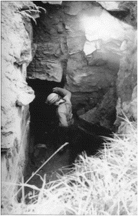 |
On 03/08/68, Richard Peat, Greg Smith, Roger Wallington, and Malcolm Cotter were exploring near Middle Flood (Waterwheel) Swallet when a camper, Peter Anderson, enquired about the 'mine-shaft' higher up the valley. The party asked to be taken to it, their curiosity dosed with scepticism. On seeing the hole, all such doubts were lost. Near the bottom of the shaft a number of timbers were visible and a square flat-roofed tunnel led away. There was no evidence that water had flowed over the top of the shaft which, presumably, must have been under-mined by water from below. With rising excitement they entered the cave, realising that after all the hard years of digging it seemed at last we would be able to explore the great cave which collects the waters of the valley. A short way in a drop of 3m (now the first flight of steps) offered a small climb beyond which a hole gave access to a flat-out craw in a drainpipe. Progress could only be made by breaking small straw stalactites. Another short drop emerged at the side of a small stream passage. This section was well decorated and was named 'Stal Pot' (now the second flight of steps). On this visit there was a heap of sand and turfs on the floor. Downstream a passage 17m long turned into a mud wallow. The way on was blocked by a flowstone barrier behind a shallow pool. At roof level a slit only inches high continued with a few straws bearing traces of flood debris. Exploration upstream revealed a roomy boulder chamber, the walls of which contained numerous protruding fossils. Progress at one point was stopped by a band of chert completely dividing the passage. This was easily broken and progress continued to a small chamber containing a chert bridge and good calcite formations. It ended at an impenetrable sump. Exploration for the day ended leaving the party somewhat disappointed. Blackmoor had closed its secrets yet again |
Greg Smith, entrance to
Upper Flood Swallet photo R Charnock |
The following day a survey was undertaken and this showed the cave was 83m long and 13m deep. |
Work at Upper Flood Swallet began immediately with a clearing operation. There was much evidence of the presence of lead miners. Most of the roof above the first drop consisted of large boulders, once held in place by now long-rotten timberwork, and succeeded by calcite cement. In the floor above the drop a board was found buried in the mud, while rope marks were discernible in the left hand wall above it. It is thought that miners diverted water down the swallet, using it as a drain. As much of this water would have been derived from the buddle pits used for washing lead ore it would have been heavily silted. Presumably the swallet required some attention to keep it clear - the board appeared to be part of a sluice, the rope marks are thought to have been caused by dragging out buckets containing the silt. Subsequent analysis of cave mud deposits indicated a very high lead content.
 |
 |
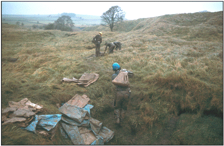
Spoil hauled out to the surface
photo G Barton 1982 but the method was the same in the 60's and 70's |
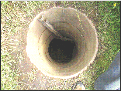
Concrete pipes lining the entrance
photo B Chadwick |
The excavation of the entry passage in Upper Flood Swallet continued with the removal of roof and floor of the drainpipe. Slabs of rock from the roof were used to construct the steps down the first drop, and also at Stal Pot. During this work a passage behind the first steps was sealed with spoil.
Work on enlarging the passage continued through 1968-71 and spoil was deposited outside the cave beyond a wall of heavy boulders. Sections of the concrete pipe were rested on the wall so as to preserve access through the increasing depth of spoil which was being dumped outside.
In late 1971 work was started in the entrance passage by the (non-MCG) team who had excavated Reservoir Hole - consisting of Willie Stanton, Tom Evans, Frank Reynolds, Willie Edwards, and Alan Trickey. The aim behind their work was to establish a walk-through to the final obstruction, where more powerful methods could then be brought to bear. By a strange twist of fate this part of the valley had been sold since MCG commenced digging. The Charterhouse Caving Committee, who originally controlled access on behalf of the Bristol Waterworks were informed of the sale but details did not reach MCG. The Reservoir Hole team sought permission of the new landowner and began digging, unaware of MCG's efforts and our existing permission to dig. Likewise, the MCG were unaware of the Reservoir Hole team and their permission to dig! The obvious solution was to have a joint dig - and in this way work continued in December 1971, with WCC digging mostly midweek and MCG digging at the weekends.
Systematic work on enlarging the small entrance crawls in Upper Flood Swallet was carried out by the Reservoir Hole team working midweek evenings, and the MCG at weekends. By the Easter 1972 the passage had been enlarged as far as a calcite blockage. Here the water trickled away into an impenetrable fissure. It was clear that extensive blasting was the only means of making effective progress. After some further weeks of work a stage was reached when water could be heard running away in the constricted passage ahead.
On the 11/06/72 MCG members John MacMillan, Peter Mathews, Pat Walsh, and Don Vosper forced their way through a flat-out squeeze with little air space over liquid mud. They found themselves in a well decorated passage which enlarged into a roomy chamber festooned with formations. The chamber descended more steeply at the far end and closed down, but a way on was achieved with little effort.
Beyond, a narrow passage was encountered which contained thixotropic black mud about 0.6m deep. On the first crossing the explorers were able to walk across it with ease; subsequently it became difficult to extract oneself. The passage lowered to a wallow and ended once again at a stalagmite now known as the Stal Boss. The Boss did not form a total obstruction and an extension could be seen on the far side.
Only one side passage was found, an inlet entering the left-hand side just before the wallow. It originally contained some superb formations, but was later used for storing spoil. A flood mark was noted about 0.7m above the top of the floor at the top of the inlet.
The next breakthrough came on 18/08/72 when the Reservoir Hole team of Tom Evans, Frank Reynolds, Willie Stanton, Alan Trickey, together with Malcolm Cotter (MCG) passed the Boss into 5m of passage ending in another almost total blockage. Water flowed away through a small slot at the base of the obstruction where digging recommenced. Trouble with blockages was frequent - there was danger of flooding rendering the approach passage inaccessible.
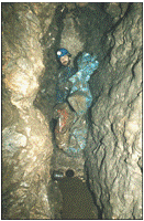
After some 6m tunnelling through solid rock, another breakthrough was made by members of the Reservoir Hole team. The passage widened and the floor dropped, revealing a long descending chamber. From here the passage continued for 10m ending in a horizontal slit above a dam of glutinous mud. Beyond, the stream could be heard cascading over a drop. It was apparent that open cave did not go as far as the tell-tale flood debris that was deposited on the roof.
 |
Once the lip of the dam had been breached the obstacle was easily passed, and on 03/12/72 a short drop of 2m was descended. Almost immediately the stream vanished in a loosely filled floor; progress was halted again. Ahead, the passage was entirely filled with an ancient deposit composed mainly of calcite with pockets of red clay and occasional voids. The infilled passage was sometimes so narrow that bedrock had to be removed. Below the clay a stalagmite floor was reached on occasions. Drainage of water was again restricted and the passage often became a canal. In dry conditions water drained down two excavated holes on the right of the passage, presumably finding a route through sediments under the floor. This feature of water flow below the floor occurs throughout this part of the cave. At different stages dams were constructed; at the first break-through point; just after Stal Boss; and in this lower section. Dams were made both to keep the working face dry, or at least free from flooding, and to wash away the mountains of mud. By 1976, 235m of new cave has been discovered, at a cost of excavating 15m of totally blocked, and 25m of partly blocked, passage. |
One of the dams
photo G Barton |
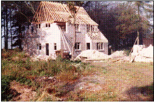 |
During blasting and clearing operations in 1976 we encountered a mass of black mud (tailings from lead working) blocking the upper half of the passage. Expectations rose when a probe hit a free space on the far side. As usual our feverish digging gave way to disappointment when the cavity came to an end after 1m. Digging downwards revealed that the stream was in a water-filled cavity which shelved sideways about 1m on the left. Very little other work was done in the cave between 1976 and 1981 since all our effort was directed to building our third cottage! |
Nordrach Cottage under construction
in 1979, photo R Saunders |
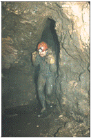
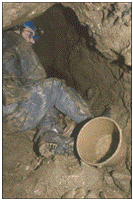
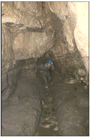
With the new cottage com-pleted attention returned once more to Upper Flood. The initial task was to tidy up the approach face which took several trips. Blasting and clearing of the calcite obstruction then continued. About half way through 1982 we found for the first time that the calcite blockage projected below water level and this gave us hope that we had reached the final spoil dam. On breaching the calcite we encountered mud and water which could be probed for 1.5m without finding the bottom. But another calcite barrier lay ahead so work continued.
 |
 |
 |
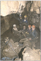 |
A digging trip in the early 1980's, photos G Barton |
A new system of spoil removal was initiated, involving dragging fully loaded skips from the dig face right out of the cave. This proved far superior to the old method of using poly bags.
| Click to continue to next page |
or jump to:
| Back to top |
Page created 06 October 2009, last updated 14 February 2010 |
Mendip Caving Group. UK Charity Number 270088. The object of the Group is, for the benefit of the public, the furtherance of all aspects of the exploration, scientific study and conservation of caves and related features. Membership shall be open to anyone over the age of 18 years with an interest in the objects of the Group.