|
|
Upper Flood Swallet surveys
Upper Flood Swallet in relation to the surface
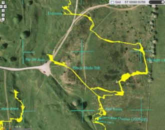 |
Click image or here to see an overlay of Upper Flood Swallet and other caves of the Blackmoor valley in relation to the surface (survey courtesy of Ben Cooper, Google maps courtesy of Bill Chadwick). Normal left mouse drag to pan, double left click to zoom in, double right click to zoom out or mousewheel zoom. Press the round blue ? button for help.
|
Upper Flood Swallet survey at December 2012 (pdf version)
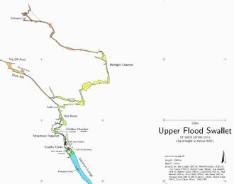 |
Click image or here to see the latest Upper Flood Swallet survey (courtesy of Ben Cooper)
This work is licensed under the Creative Commons Attribution-Non-Commercial-Share Alike 2.0 UK: England & Wales License. Copyright 2012 Mendip Caving Group. To view a copy of this licence, visit http://creativecommons.org/licenses/by-nc-sa/2.0/uk/
|
Upper Flood Swallet survey at December 2012 (HTML)
 |
Click image or here to view the December 2012 Upper Flood Swallet survey, quickly in your browser. Normal left mouse drag to pan, double left click to zoom in, double right click to zoom out or mousewheel zoom.
|
Photos pinned to the survey
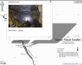 |
Click image or here to see photos of Upper Flood Swallet pinned to the latest survey. Normal left mouse drag to pan, double left click to zoom in, double right click to zoom out or mousewheel zoom. There is a panel at the top right that displays the mouse-coords in ST grid square metres. As you mouse-over a green photo marker, a small copy of the photo appears at the top left of the page. If you click a green marker you get a pop-up with a bigger copy of the picture and a link to the full size original.
|
|
If any club member wants to have a go at pinning some photos, then please ask the web master for the necessary credentials and instructions.
|
Upper Flood Swallet, 0-3.5km in 90 seconds
|
|
A timelapse survey showing how the cave has been extended by Mendip Caving Group (with help initially from the WCC) since it was discovered in 1968. At the rate of 2 seconds per year, the video takes about 90 seconds to play. When a breakthrough to new passage is made, exploration can be rapid and the survey grows quickly. At other times progress is slow and no change happens sometimes for several years. Hint - watch out for 2006!
|
How it's done - putting the Upper Flood Swallet surveys online
Publishing Ben Cooper's survey online was achieved by MCG member Bill Chadwick, a Google Maps API developer. The survey could be shown on Google Maps using KML files or GPolylines/GPolygons, but those techniques require that you have detailed coordinates of the objects you want to plot. Instead, Bill uses a free Microsoft application MapCruncher for Virtual Earth. MapCruncher reads in the survey or map (jpg, transparent png, PDF, etc.), lets you register it with the real world and at the click of a button, makes a tile set ready for use as a custom GMaps tile layer. This works because by happy coincidence, Microsoft Virtual Earth and the Google Maps API use the same map projection and tiling scheme. MapCruncher takes care of all the rotating and warping of your map that is required for it to correctly appear in GMaps.
If this sounds like something you want to try with some maps of your own, you can read his comprehensive set of instructions on using MapCruncher with Google Maps.
Shetland Attack Pony
The Upper Flood survey is being carried out with the Shetland Attack Pony. For information click here
Other surveys (click to enlarge)
|
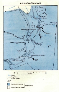
1976 area plan
 |
1976 cave survey
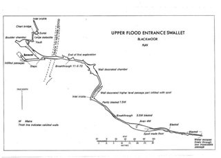 |
|
1996 cave survey
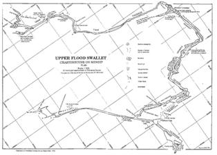 |
2007 cave survey
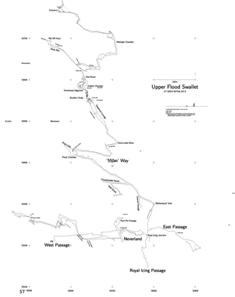 |
|
Progress 1968 to 2007
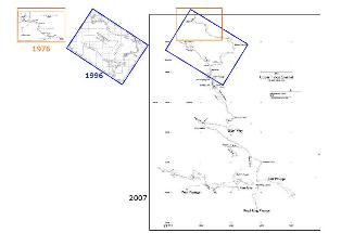 |
|
|
|
| Back to top |
Page created 18 December 2008, last updated 25 November 2013
|

HTML not valid
due to Flash
|

|
Mendip Caving Group. UK Charity Number 270088. The object of the Group is, for the benefit of the public, the furtherance of all aspects of the exploration, scientific study and conservation of caves and related features. Membership shall be open to anyone over the age of 18 years with an interest in the objects of the Group.
|