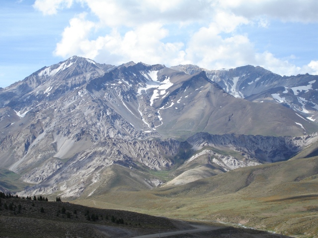
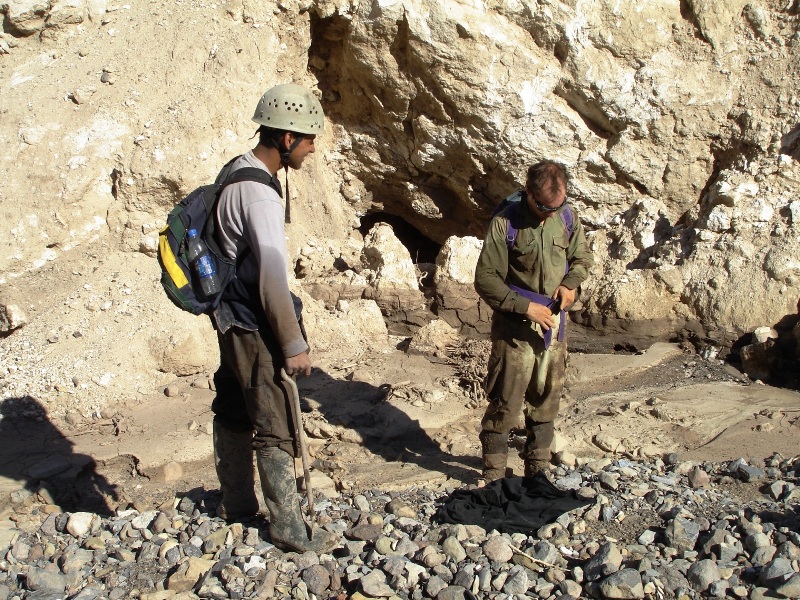
Las Leñas: MCG in Argentina 2006by Tim Francis This year's team in Malargüe, February 2006, was just the usual three of us from the UK - Peat Bennett, Richard Carey and I - plus our friends from INAE. Again we had less than two weeks in the field so our focus was to really crack open the potential of the caves at Las Leñas. On the last trip in 2004, we had only cursorily looked at the valley but had noted more than 15 sites of interest including Cueva Naranja, Cueva Langosta, and Cueva de la Nieve. Valle de Las Leñas
But in 2004 it was readily apparent that there was huge potential. The depth of the gypsum is significantly greater than that at Poti Malal, and with the mountains soaring to over 4000m it really was worth a proper look. We only had a few days at Las Leñas as our focus was to complete the survey of Cueva Miranda over at Poti Malal. But we noted resurgences at almost 3000m and 16 sites of spelaeological potential, not bad for an area considered to have no caves. The main discoveries were a big resurgence below Monte Leñas, Cueva Naranja and Rio Naranja, Cueva Langosta and Dead Colibri Cave. None of which are particularly long but there is hell of a lot of water coming out of the mountains. The problem we've found with Gypsum is that you just can't seem to follow the water very far before the cave closes down or collapses. So in 2006 we were absolutely determined to focus on Las Leñas. Indeed we had muttered that we probably would not have time to visit Poti Malal which is almost sacrilege in these parts. Carlos lined us up some extremely cheap off-season accommodation at the ski resort; beds, a shower, an electric hob, a shop. This was true luxury compared to the usual cold and dusty camping. Indeed from our room's window we had a fantastic view of the gypsum mountains, "Cerro Yeseras", in the distance. Peat had a good pair of binoculars so we were even able to indulge in some armchair cave spotting. The Resurgences of Las LeñasThe appeal of cave exploration in the valley is that you can do day trips from the end of the tarmac road. Indeed the furthest reaches of the Gypsum are only 3-4 hours walk away so there was no need for camping. Mind you, day after day of high altitude walking can get rather tiring to say the least. The caves are 500-1000m higher than at Poti Malal so they can be very cold. Mendip kit is definitely advisable for anything other than a quick recce. 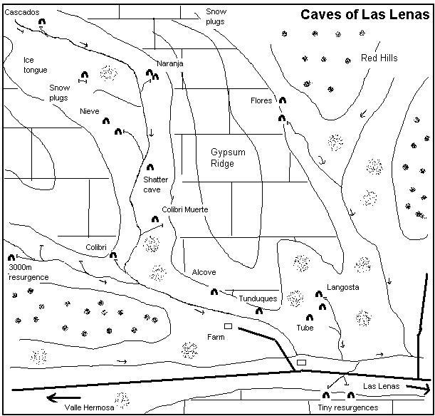 Cueva del ColibriOn the first day we thought we'd go for an evening's stroll to look at the main resurgence. Just follow the main river from the farmhouse at the end of the valley and you can't miss it. The others went up to Tunduques instead for a spot of tourist caving. Things had changed since 2004. The cliff face above the entrance had collapsed and there is now a nasty overhang. Not ideal.
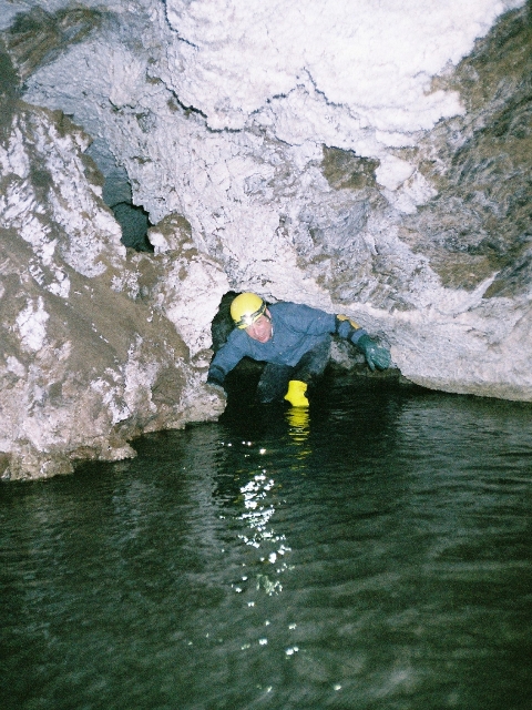
We tried to dig around the choke on the left but this looked long term. On the surveying trip Peat spotted that the main streamway was actually coming out of a low scoop on the right hand side. We duly surveyed into this but the streamway got lower and lower. Peat commented "this turned out to be a surveyor's hell involving crawling in freezing cold water. Enough was enough when I could hardly move my limbs due to the cold." We left it at a flat-out hypothermic bedding plane that twisted out of sight. On the final day, Peat and Rubèn did a mad dash to the end in full Mendip kit to see if they could push it. Again they were beaten back by the cold. It looks very unpromising but possibly in a thick wetsuit further progress might be possible. The current length stands at 125m. Cueva Naranja
Colibri MuertoThis was a small site we'd found in 2004 and so-named because of dead bird at the entrance. It's an unpromising grovel in the scree of gypsum on the left hand side of the huge resurgence on the other side of the valley from Colibri Cave. Towards the end of the trip Peat and I nosed around in every hole looking for a way passed the huge tumble of boulders that block the main resurgence. There really is nothing here but the nature of the gypsum means that it is worth checking every few years just in case. Just for the hell of it we looked at Colibri Muerto. This time there was a stream running down the cave whereas it had been bone dry in 2004. Cueva de la Nieve
Anything above 2500m in this area seemed to be snow-plugged. We did come across a tiny resurgence and sink in a doline but not much else. The highlight of this tour of the hills was a natural rockarch carved out of glacial debris by a meltwater stream. This lay right at the foot of a tongue of ice and afterwards we realised that we could actually see it through the binoculars all the way from the ski resort. Cueva de Las cascadas
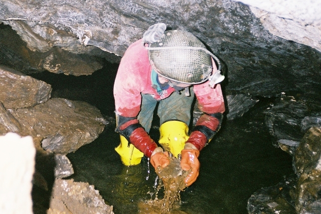
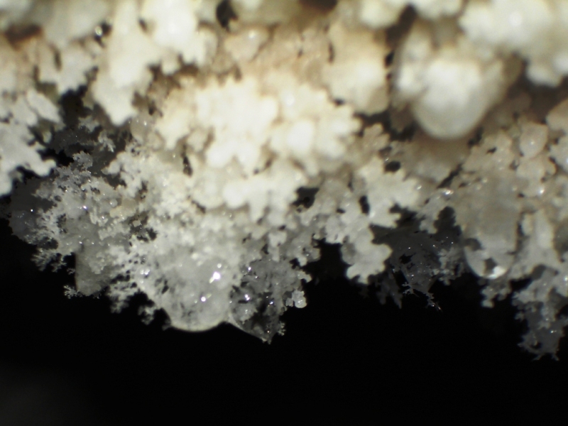
Another junction was met. Straight ahead runs for 50m or so until it closes down at a dry choke. The passage smelled heavily of sulphur, hence the name. It does draught though and we know from the survey that it lies close to the cascades at the end of the cave. The main streamway twists off to the left into a Yorkshire-style series of meanders. The gypsum is extremely hard here so the water has scoured a delightful series of twists and turns. This section of meanders emerges, via a chossy choke into a very large boulder slope with a streamway crashing down from above. This was really exciting stuff. At the top of the slope it all closes down in the inevitable boulder choke. I pushed this along the solid left wall as far as I felt was prudent but it does continue. That's one for someone of a less nervous disposition I can tell you. Above the meanders is a second, but smaller, series of passages we named The Tubes. These phreatic wriggles meet up with the meanders at the choke at the base of the cascade which makes for a pleasant, if cold, round trip. They are also unusual in that there is a small grotto of straws. You don't tend to see much active stal at this altitude. Side valley ramblesAs well as looking at the main valley we wanted to look around the back of the gypsum ridge to see if there were caves on the side and round the back. There is a tributary valley that starts a little bit closer to Las Leñas with a broad flat floor at its mouth. We had looked at the lower levels of this valley briefly in 2004 and found Cueva Langosta and another flood prone looking crack. We knew that there wouldn't be much gypsum to traverse as in flood the river runs orange rather than grey. So we walked up the valley one day, hugging the gypsum on our left and checking out ever nook and cranny. For a laugh we climbed up over 3000m to peer over into the main valley and onwards to cascadas in the distance. It was no surprise that all the depressions at this height were filled with snow. Peat and Rubèn, our mountain goat duo, climbed up even higher for some fantastic views of the Andes all around. Cueva de Las FloresOne reasonably-sized resurgence was spotted but the water runs out of a too-tight crack. Elsewhere all the depressions in the gypsum are blind apart from one small, and very pretty, cave. It is only 25m in length, but very pretty at the back. There does seem to be very little potential on this side of the mountain. A longer-term plan would be to walk / ride in to the mountains to get to the gypsum right around the back. This would be quite an epic in this terrain and definitely involve camping. Back to Cueva Miranda, Poti Malal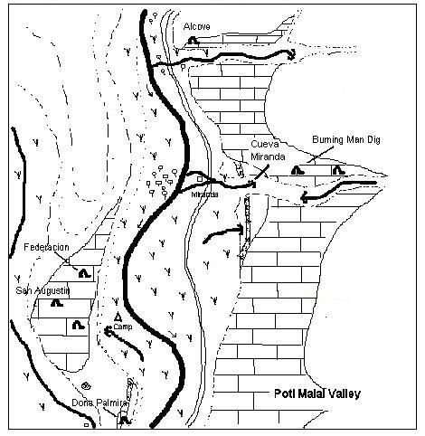 Yes, despite our good intentions we did end up back at Miranda after all. However there was a good reason for this. There had been some pretty serious floods a few months before and Carlos was keen to check out the effects. San Agustin had really taken a battering with several large boulders crashing down the entrance slope. There is now a large trench in the scree slope. Top sink, Cueva Miranda
Malargüe Hills and ValencianaRound the back of Malargüe are some low scrubby gypsum hills, Barda Blanca. We spent a frustrating and extremely hot afternoon looking for caves here. But there is nothing. Also in the foothills off the main road at El Chacey we had heard about an abandoned gypsum quarry. We were stopped by some farmers at a gate who said that we would need to speak to the landowner. So something to set up for the future perhaps? Finally we had an idea about trying to get onto the gypsum on the horizon beyond Valenciana. We'd seen and photographed this many years ago but never visited the area. It is of interest because it forms the northerly end of the limestone / gypsum ridge that you see at Brujas further to the south. Unfortunately they've re-opened the gypsum quarries in the area so everything was fenced off and strictly off limits to itinerant cavers. That's one for the future. Outstanding projectsAfter six trips to Malargüe we have now exhausted all the obvious caving areas in the area. There are of course pockets of gypsum scattered about in the Andean foothills between Brujas and Las Leñas. But without any tarmac roads or public access these will be extremely tricky to explore. On several occasions we have come across verbal references, spoken to local farmers, hearsay and notes on maps that indicate the potential for cave. But these will require considerable effort to follow up without any guarantee of new cave, and would be best recced first by our friends in INAE. Our remaining medium term leads, without resorting to bang, are as follows:
If we return again we will be looking to explore a completely new region but we have no firm plans yet. TeamPeat Bennett, Ariel Benedetto, Carlos Benedetto, Richard Carey, Rubèn Cepeda, Ricardo Fernández, Gaston, Tim Francis Colibri A Colibri is a small brightly coloured bird, indigenous to this area. I think it's a type of finch.
Mendip Caving Group. UK Charity Number 270088. The object of the Group is, for the benefit of the public, the furtherance of all aspects of the exploration, scientific study and conservation of caves and related features. Membership shall be open to anyone over the age of 18 years with an interest in the objects of the Group. |